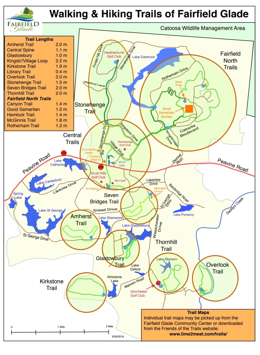
hiking trails
trails
scenery
Wildlife
trails
central trails
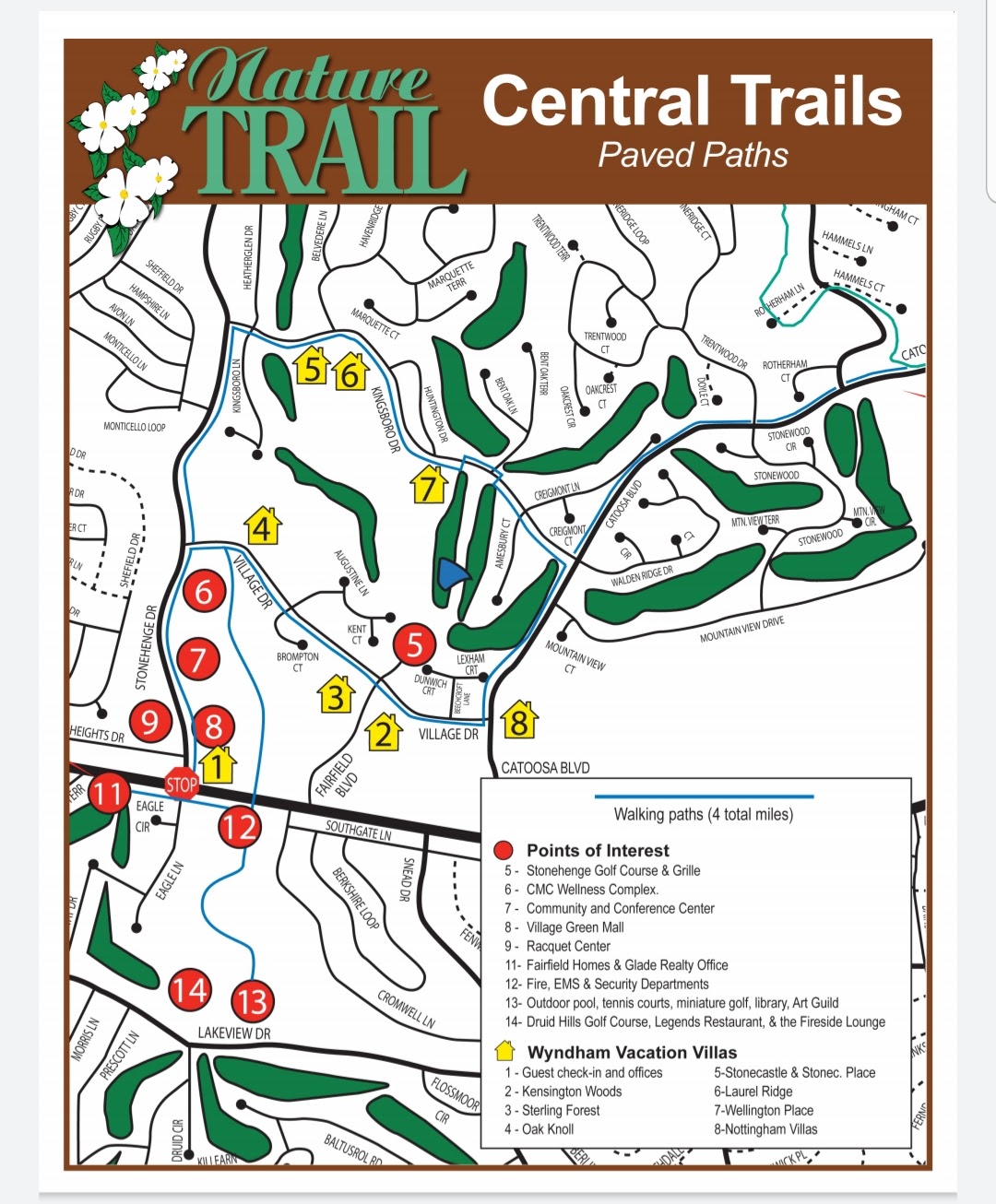
The Central Trails are the 4.6 miles of easy paved sidewalks in the Central region of Fairfield Glade with a 1.0 mile section that meanders through the woods from Druid Hills to Village Drive.

north trails
The North Trails Map includes a number of interconnected hiking trails in the northern region of Fairfield Glade. There are significant changes in elevation.
The Rotherham Trail is a 1.1 mile moderate trail. The lower section of this trail is an easy half-mile hiking trail along a creek. The upper section is more strenuous so hiking in the downhill direction is recommended!
The Hemlock Trail is 1.3-mile trail with a slow steady climb.
The Good Samaritan is a 1.0 easy trail.
The McGinnis Trail is a 1.8 mile moderate trail with significant elevation changes.
overlook trail
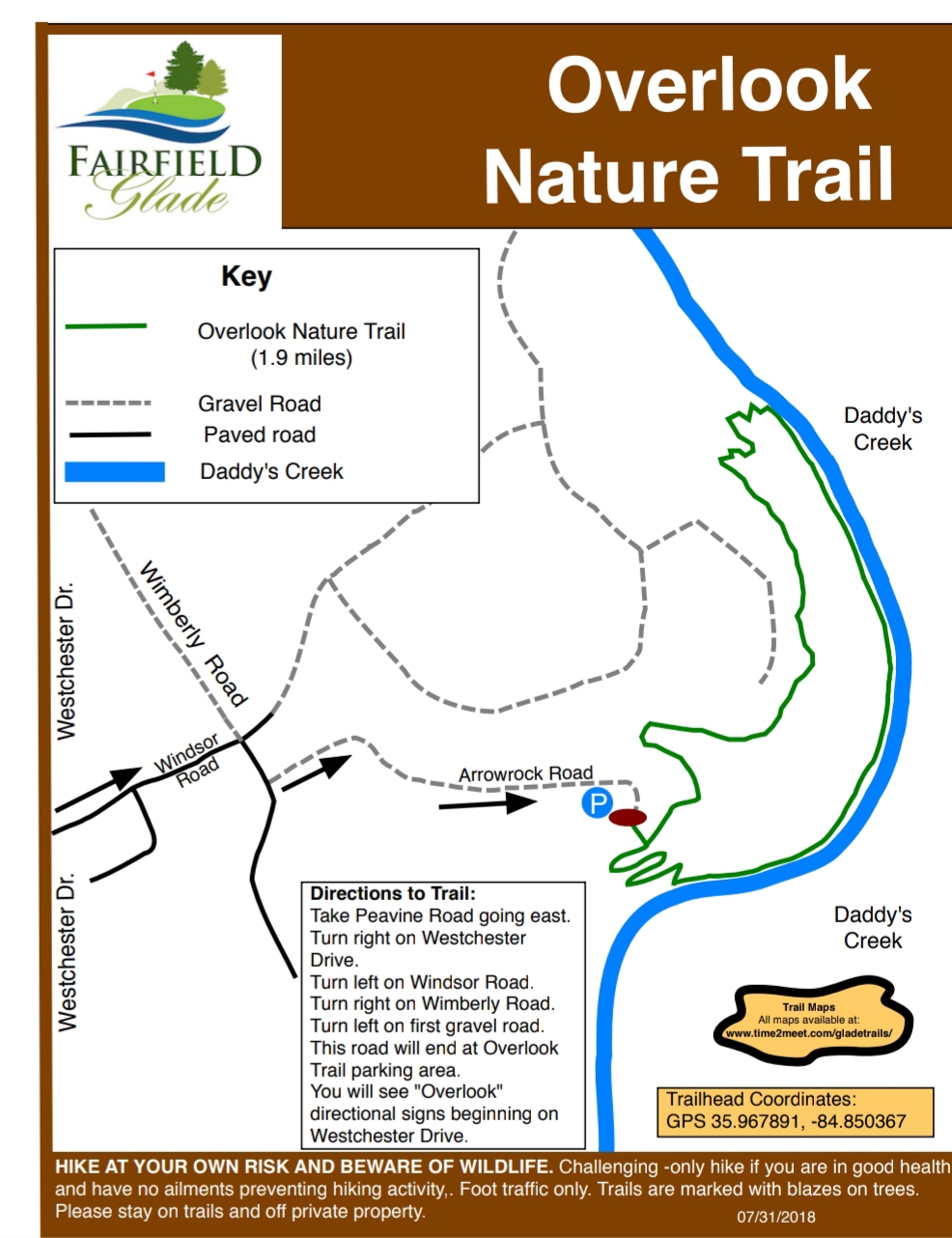
The Overlook Trail is a 1.9 mile moderate loop trail in the southern region of Fairfield Glade. The trail borders Daddy’s Creek for about a mile and ends in a rather strenuous climb out of the creek valley.
stonehenge trail
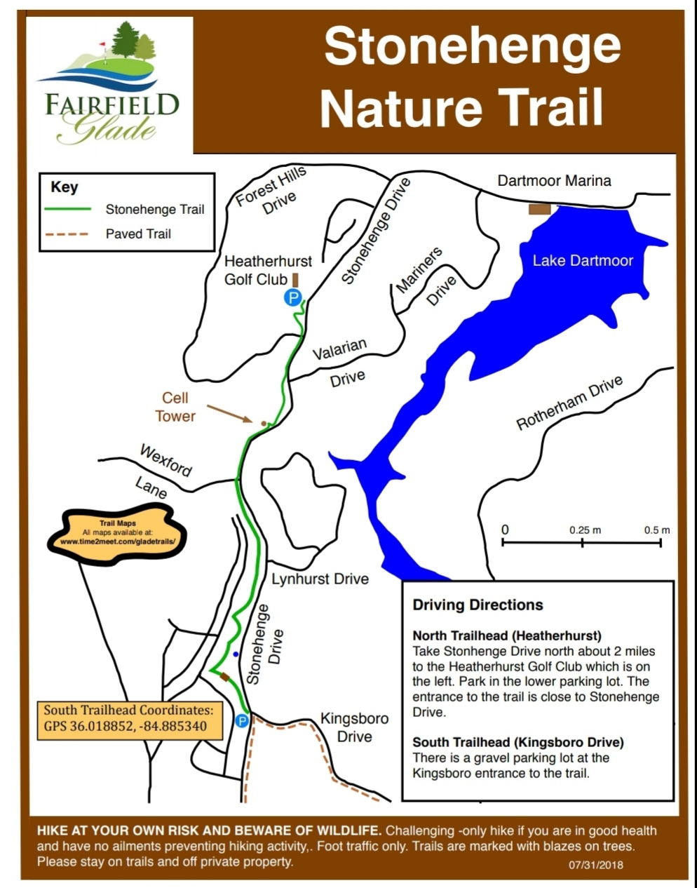
The Stonehenge Trail is a 1.5 mile linear trail that goes alonside Stonehenge Drive from Kingsboro Drive to Heatherhurst Golf Club.

seven bridges trail
The Seven Bridges Trail is a 2.0 mile easy “lollipop” woodland trail that starts and ends at the Methodist Church on Westchester Drive.
amherst trail
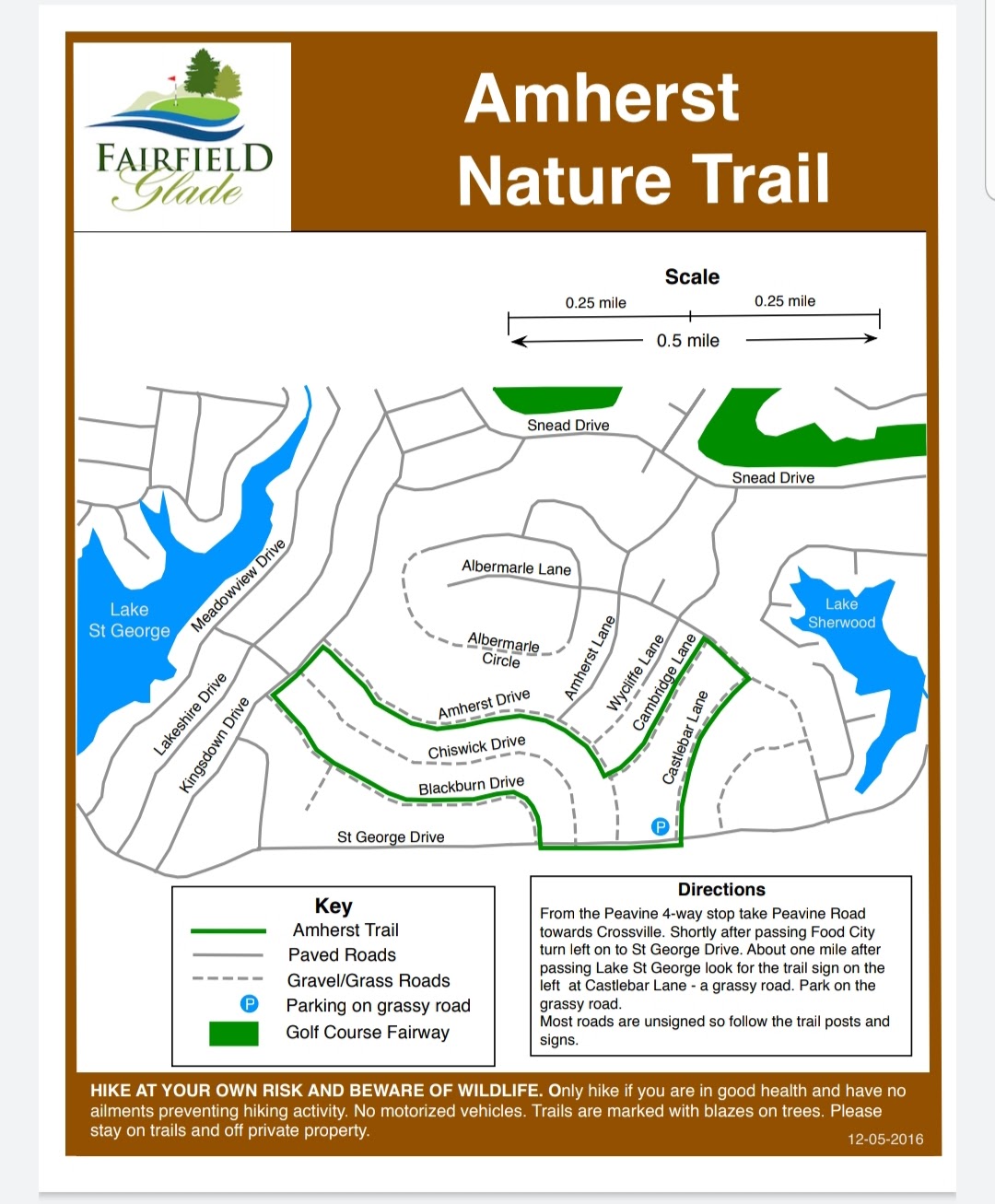
The Amherst Trail is an easy 2 mile hiking trail mainly on “grassy roads.” There is very little change in elevation but there may be ticks and chiggers in the grass except in Winter.

thornhill trail
The Thornhill Trail is a 1.8-mile easy hiking trail mainly on “grassy roads.” There is very little change in elevation but there may be ticks and chiggers in the grass except in Winter.
kirkstone trail
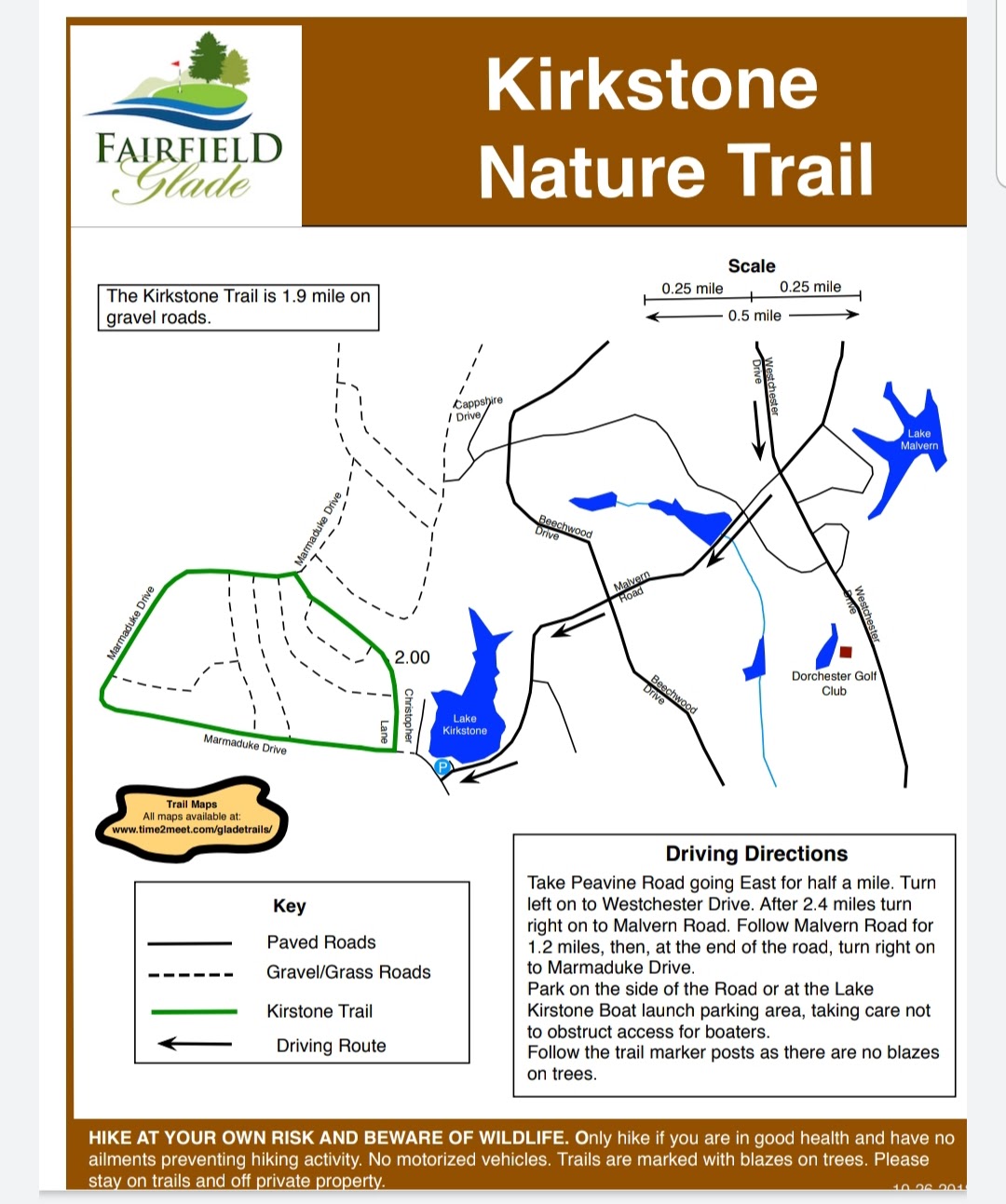
The Kirkstone Trail is a 2-mile moderate hiking trail mainly on “gravel roads.” There is some change in elevation.
glastowbury trail
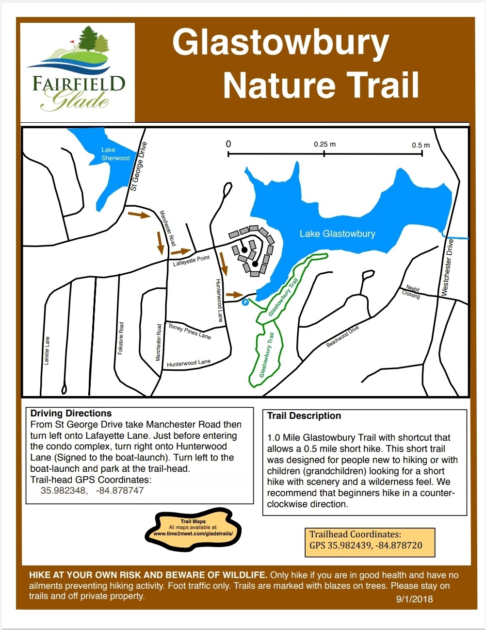
The Glastowbury Trail is a 1-mile easy hiking trail. There is some change in elevation.
fairfield glade hiking trails
